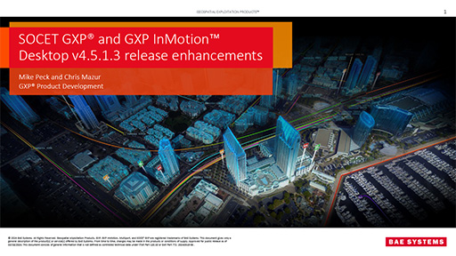
SOCET GXP® v4.6
Advanced geospatial exploitation and customized product creation combined into one comprehensive solution
Request additional info or a product demo
Capabilities
SOCET GXP® ingests imagery from satellite and aerial sources enabling users to identify, analyze, and extract ground features while supporting rapid product creation. Image analysis, advanced photogrammetric techniques, remote sensing, and feature collection workflows are seamlessly combined into a single, effective solution that delivers the most advanced exploitation of geospatial data.
Imagery Analysis and Intelligence Production
Bringing light to the complexities of your geospatial data, SOCET GXP software enables users to examine every facet of an image with a wide selection of tools including anomaly detection, supervised classification algorithms, and powerful enhancement tools. Complex terrain and temporal analysis tools can be used to improve situational awareness and deliver actionable intelligence to field personnel.
- Advanced imagery analysis and remote sensing
- Synthetic Aperture Radar (SAR) Processing and Analytics
- Multi-spectral and Hyper Spectral Analysis
- Precise Mensuration with Rigorous Sensor Models
- Space Domain Awareness
- Multi-sensor Triangulation and Registration
- Targeting Solutions
- Image Orthorectification
- Multi Image Analysis
- Annotation and Feature Creation with Geodatabases
- Esri Workflow Integration
Object Detection
Utilizing both Artificial Intelligence / Machine Learning (AI/ML) and traditional algorithmic techniques, SOCET GXP is able to automatically detect objects in a given Area of Interest (AoI).
- Structured Observation Management (SOM)
- Automatic Target Detection (GXP GATOR)
- AI and Machine Learning detection and classification
- Activity Reporting Tool
- Visual Profiler
- Visual Profiler for SOCET GXP Fielded Versions
Terrain and LiDAR
Create and visualize bare-earth terrain files, surface models, and point clouds. The 3D Multiport™ gives analysts a comprehensive view of their data and allows for LiDAR data to be merged with imagery, other terrain models, and 3-D features. Users can quickly switch visualization methods for LiDAR point clouds including colorization by elevation, classification, return level, or imagery.
- 2-D and 3-D Visualization
- Automatic Feature Extraction
- 3-D Feature Extraction
- 3-D Mensuration
- 3-D Modeling
- Terrain Generation and Extraction
- Advanced Terrain Analysis Tools
- Interactive Terrain Editor
Motion GEOINT
Locate video assets across an enterprise, no matter where the data is stored or geographically located, with GXP Xplorer® software. Perform video analysis tasks with the GXP InMotion™ application and export the finished products to SOCET GXP software for even more advanced analysis, annotation, product creation, and delivery.
- Video Streaming
- Video Exploitation
- Track Analysis
- Visualization of GMTI
Standard Templated Products
SOCET GXP software enables development of advanced, customized geospatial products and reports that support collaboration with colleagues and mission partners in the field. Allows both pre-defined and custom product templates. Product templates display with labels extracted from various sources that include imagery metadata, classification markings, system date/time, and user login name.
- Imagery Products
- Microsoft PowerPoint
- Microsoft Word
- 2-D and 3-D GeoPDF creation
- Collaborative Response Graphic® (CRG®)
- USMTF
Developer Resources
The SOCET GXP DevKit contains C++, Python, and JavaScript® libraries that allow applications developed by third-parties to interact with the SOCET GXP software application through actions such as loading images, creating graphics, adding in image processing algorithms, and more.
- SOCET GXP Developer's Kit
- Robust APIs
- GXP DevLab Integration Program
Remote Sensing
Adhering to prevailing international standards, GXP® software is renowned for its wealth of sensor models, supporting numerous electro-optical, infrared, multispectral, hyperspectral and synthetic aperture radar (SAR) and LiDAR sensors. Many GXP sensor models are rigorous (i.e., they mathematically model the physical characteristics of the sensor), providing a degree of accuracy far above standard models which generally fit the physical system but don’t replicate its inner structure.
SAR Capabilities
Amplitude Change Detection
- Two-color multi-view (2CMV)
Anamorphic Correction
- Toggles square pixels for Sensor Independent Complex Data (SICD)
Automatic Application of Enhancements Based on Image and Sensor Type
Coherent Change Detection
- Automatic registration
- Coherence image output
- Goldstein filtering
- Interferogram / phase interferogram generation
- Spatial smoothing
- Support for the following sensors:
- COSMO-SkyMed
- KOMPSAT-5
- NITF (CMETAA)
- RADARSAT-2
- Sentinel-1A
- SICD
- TanDEM-X
- TerraSAR-X
Colorization
- Customizable look-up tables
Complex Data Visualization
- Allow real-time switching to view phase, inphase (I), and quadrature (Q) data
- Convert I and Q values to magnitude on the fly
- COSMO-SkyMed complex (HDF5)
- KOMPSAT-5 complex (HDF5)
- PALSAR-2 complex (CEOS/TIFF)
- RADARSAT-2 complex (TIFF)
- RISAT-1 complex (CEOS)
- Sentinel-1A complex (TIFF)
- SICD
- TanDEM-X complex (COSAR)
- TerraSAR-X complex (COSAR)
Interferometric Pair Finder
- Define matching collection geometry thresholds
Legend
- On/off toggle showing relevant collection geometry for SAR images
Ortho On-the-Fly™
- Works for complex, detected, and derived products
Orthophoto Generation
Polarimetric Color Composites
Polarimetric Decompositions
- Accomplished using Band Math functionality
- Pauli decompositions
Rigorous SAR Sensor Models
- Capella
- COSMO-SkyMed
- COSMO-SkyMed complex
- COSMO-SkyMed 2nd Generation
- KOMPSAT-5
- KOMPSAT-5 complex
- PALSAR-2
- PALSAR-2 complex
- RADARSAT-1
- RADARSAT-2 complex
- RADARSAT-2 north aligned
- RADARSAT-2 orbit aligned
- Sentinel-1A complex
- Sentinel-1A GRD
- SICD
- Sensor Independent Derived Data (SIDD)
- TanDEM-X
- TanDEM-X complex
- TerraSAR-X
- TerraSAR-X complex
SAR Overlay™
- View important collection angles
Slant to Ground Plane Toggle
Sub-Aperture Stack
- Anamorphic correction toggles square pixels for all output frames
- Color composite sub-aperture stack generation
- Configurable number of output frames
- Customizable animation rates for visualizing stack as a movie
Terrain Extraction from Stereo SAR Imagery
- RADARSAT strategy included
- Bare earth terrain generation (DEM)
- Surface model terrain generation (DSM)
Threshold Look Up Tables
- Filters out low returns while highlighting high returns
Transparency Threshold
Spectral Capabilities
Anomaly Detection
- Gaussian mixture
- Global
- Local
Atmospheric Correction
- Dark subtraction
- Internal average relative reflectance
- Reflectance calibration (empirical line method)
Band Composites
Band Math
Band Preview
- Quickly cycle through all bands
- Single button click for masking and color channel assignment
Band Ratios
- Customized band ratios
- Normalized Difference Vegetation Index (NDVI)
- Normalized Difference Water Index (NDWI)
Band Statistics
Change Detection
Classification Raster Refinement
- Includes real-time algorithms:
- Cluster
- Fill
- Filter
Colorization (single band)
- Dynamic look-up table creation
Components Analysis
- Independent components analysis
- Minimum noise fraction
- Principal components analysis
- Spectral unmixing
Convolution Filters
- Edge detection
- Sharpen
- Smooth
Decorrelation
Generate Vectors
- Customized auto-attribution (area, perimeter, etc.)
- Supervised classifications and colorization bins
Histogram Manipulation and Transforms
- Adjusted linear %
- Equalization
- Fixed multiplier
- Invert pixels (individual or all bands)
- Linear %
- Linear 2%
- Linear fixed
- Fixed multiplier
- Min/max
- Normalization
- Square Root
Image Enhancements
- Brightness, contrast, gamma, saturation, and sharpness
- Dynamic Range Adjustment
- (DRA)
- Lock DRA
- Pseudocolor/grayscale
Image Pre-processing
- Basic destriping
Morphological Filters
- Close
- Custom
- Dilate
- Erode
- Open
Pan Sharpening
- Includes real-time algorithms:
- Brovey
- Ehlers fusion
- Intensity, Hue, and Saturation (IHS)
- IHS Near Infrared (NIR)
Scatter Plot
- Color by frequency
- Classify image from scatter plot
- Dynamic class color adjustment
Signal-to-Noise Ratio Calculations
Spectral Band Masks
Spectral Profiles
- Arbitrary
- Line
- Point
- Sample
Supervised Classification
- Point and polygon pixel selection
- Real-time thresholding
- Spectral signatures
- USGS libraries included
- Eight matching algorithms included:
- Absolute correlation
- Adaptive cosine estimator
- Adaptive matched filter
- Constrained energy minimization
- Mahalanobis distance
- Normalized Euclidean distance
- Spectral angle mapper
- Spectral similarity value
Unsupervised Classifications
- Dynamic class color adjustment
- Includes three algorithms:
- ISODATA
- K-means clustering
- Tasseled cap
Xport Multiport™
- Real-time simultaneous exploitation of multiple band combinations and spectral algorithms
- Up to 16 different views of the image
Sensor Models
- ADS40/80/100
- ALOS AVNIR-2/PRISM/PALSAR/PALSAR-2
- Arc Standard Raster Product (ASRP 1.2)
- ASTER
- Cartosat
- Chandrayaan-1 TMC
- Common Coordinate System (CCS) mosaic
- Community Sensor Model (CSM) support for user-developed sensor models
- Compressed ARC Digitized Raster Graphic (CADRG)
- COSMO-SkyMed (complex and detected)
- Digital Point Positioning Database (DPPDB)
- Direct Linear Transformation
- Earth-i DMC3
- EROS-B
- FORMOSAT-2/5
- Four-Corner
- Frame Advanced
- Generic Point Cloud Model (GPM)
- Generic 2D/3D polynomials
- GeoEye-1
- IKONOS
- KOMPSAT-2/3/5
- Landsat
- Mensuration Services Package (MSP)
- NCDRD (National Imagery Transmission Format v2.1 Commercial Dataset Requirements
- Document)
- Ortho
- PeruSat-1
- PlanetScope
- Pleiades
- Predator
- Quickbird
- RADARSAT-1 Orbit Aligned
- RADARSAT-2 North Aligned and Orbit Aligned (complex and detected)
- Rational Polynomial Coefficients (RPC)
- Replacement Sensor Model (RSM)
- RISAT-1
- SENSRA
- SENSRB
- Sensor Independent Complex Data (SICD)
- Sensor Independent Derived Data (SIDD)
- Sentinel-1A/2A/2B
- SkySat
- Smart Image
- SPOT (1-3, 5+)
- TanDEM-X (complex and detected)
- TeLEOS-1
- TerraSAR-X (complex and detected)
- United States Geologic Survey Digital Ortho Quad and Quarter Quad (USGS DOQ)
- USMSD
- VisionMap A3
- WorldView-1/2/3/4
GXP® Ecosystem
Providing the foundation for development of the most advanced geospatial intelligence, the GXP Ecosystem delivers an unrivaled capacity for discovery, exploitation, and dissemination of mission‑critical geospatial and temporal data.

GXP® Ecosystem
Providing the foundation for development of the most advanced geospatial intelligence, the GXP Ecosystem delivers an unrivaled capacity for discovery, exploitation, and dissemination of mission‑critical geospatial and temporal data.

