GXP® Solutions for Space Domain Awareness
Request additional info or a product demo
SOCET GXP®
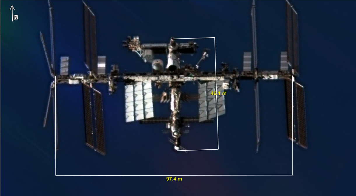
SOCET GXP® desktop software is the premiere tool for analysis and product generation among analysts across the DoD and IC communities. SOCET GXP utilizes data and imagery from satellite and aerial sources to rapidly identify, analyze, and extract features which allows for rapid Intelligence product development and better decision making.
The SOCET GXP software solution enables users to:
- Non-Earth Registration enables mensuration on Non-Earth Imagery
- Utilize airborne or satellite imagery to create 3-D models, foundation feature data, and observation data.
- Rapidly produce intelligence reports in a variety of formats enabling critical decision-making.
- Create fast and accurate precision targeting intelligence.
- Efficiently create accurate intelligence products and analysis from imagery, terrain, LiDAR, video, tracks and points, and feature stores.
- Monitor infrastructure and sites to detect, record and analyze change (Structured Observation
Management).
Additional key capabilities:
- Triangulation and registration.
- Stereo visualization and mensuration.
- Precision Point Mensuration.
- LiDAR exploitation.
- Multispectral, hyperspectral, and SAR analysis.
- 3-D feature extraction.
- Object detection.
- AI/ML workflows.
- Esri® integration.
- Earth and other planets’ sensor models.
- SIGINT on Top of Imagery – Ingest Native Hawkeye 360 GeoJSON or CSV file.
- Attributed features with error ellipses, location, time, and orientation.
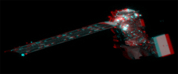
SOCET GXP stereo imagery capability.
Imagery © 2024 Maxar Technologies
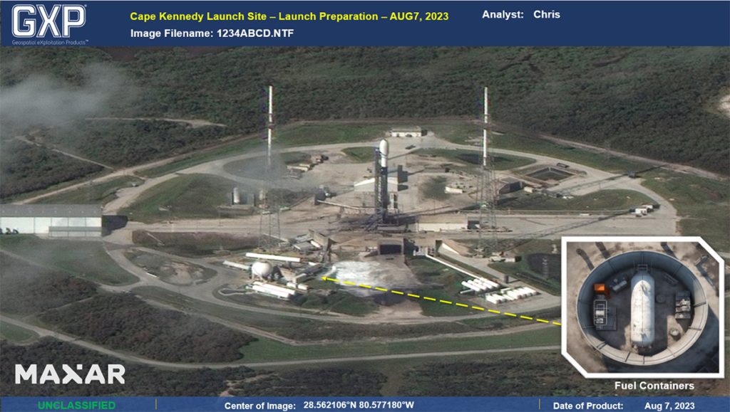
Satellite launch site analysis.
Imagery © 2024 Maxar Technologies
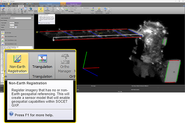
Non-Earth Registration.
Imagery © 2024 Maxar Technologies
GXP Xplorer® Platform
Providing the foundation for development of the most advanced geospatial intelligence, the GXP Xplorer® Platform delivers an unrivaled capacity for discovery, exploitation, and dissemination of mission-critical geospatial and temporal data.
Enabling efficient discovery of space-based, geospatial data, GXP Xplorer software harvests information from mutiple authoritative data sources including internal and external sources, structured and unstructured, and semi-structured datasets from a variety of network-based, file-based, and message-based interfaces. BAE Systems works on the development and integration of new space data sources and traditional ground data sources, leveraging that experience for a commercial solution that is fully integrated from space to ground.
- Data ingest, store and sync.
- Data visualization.
- Data dissemination.
- Data search and discovery.
- Data analysis.
- Open architecture and API.
Data types discoverable by either keyword or product attribute include:
- Imagery (earth, non-earth), terrain (earth, non-earth), and LiDAR.
- Space Domain Awareness data.
- Features and shapefiles.
- Maps and charts.
- Raster and vector-derived products.
- Full Motion Video (FMV).
- Motion tracks and events.
- Documents, spreadsheets, and slide presentations.
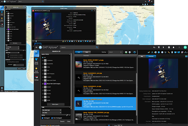
Imagery © 2024 Maxar Technologies
GXP Xplorer, and the entire GXP product ecosystem, is utilized by both all-source and image analysts at organizations across the world:
- Defense forces, intelligence agencies, and homeland security.
- Universities and research organizations.
- Systems integrators.
- State, local, and regional governments.
- Photogrammetry, mapping, and surveying agencies.
- Transportation departments.
- Natural resource management consultants.
GXP Fusion®
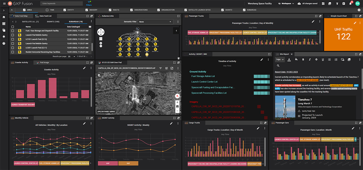
GXP Fusion® software, which enables development of a multi-INT common intelligence picture, is designed to meet the complex data challenges confronting modern Intelligence, SOM, and All-Source Analysts. GXP Fusion empowers the analyst to optimize SOM and image exploitation workflows, leverage third-party Artificial Intelligence (AI) / Machine Learning (ML) technology, and enjoy a seamless user experience.
The GXP Fusion software solution enables users to:
- Increase operational awareness using a multi-INT dashboard.
- Display geotagged products on a 3-D globe or 2-D map.
- Display geotagged and non-geotagged products in a tabular list.
- Leverage advanced SOM collection tools.
- Evaluate linked relationships between objects in a network graph.
- Create and display SOM objects on a timeline chart.
- Create and display object occurrences on a data analytic chart.
- Edit, analyze, and view results from 3rd party AI/ML image object recognition software.
- Edit, analyze, and view results from Natural Language Processing (NLP) text object recognition software.
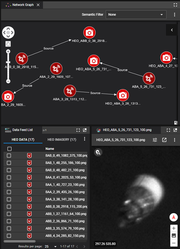
Visualize complex relationships and patterns using the Network Graph in GXP Fusion software.
Non-Earth imagery provided by HEO
GXP® Ecosystem
Providing the foundation for development of the most advanced geospatial intelligence, the GXP Ecosystem delivers an unrivaled capacity for discovery, exploitation, and dissemination of mission‑critical geospatial and temporal data.
